Camping in Rhineland-Palatinate
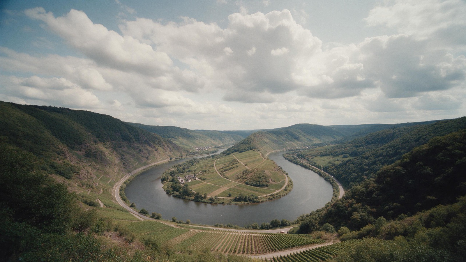
Rhineland-Palatinate is wine country and forest country at once. Along the Moselle, the Rhine and the Ahr the sites stand between steep vineyards, the Palatinate Forest is the largest continuous woodland in Germany, and in the Eifel the volcanoes left round crater lakes that are deep water today.
The year in this region
October: Sweet chestnuts drop in the Pfälzerwald
From 1 October to mid November the Pfälzer Keschdewochen run from Hauenstein to Neustadt an der Weinstraße. The Keschdeweg links the villages over some 60 kilometres. The forest districts of Annweiler and Haardt hold about 3,000 hectares of sweet chestnut, a good half of the German stock. The Romans brought the tree.
In the middle of the month the sun rises at 7:51 AM and sets at 6:41 PM. That leaves 10 hours and 50 minutes of daylight.
What nature does this month
- Beech turns to autumn colours around October 14 (usually between October 5 and October 20)
- Oak turns to autumn colours around October 20 (usually between October 11 and October 27)
Water and air: Open-Meteo, measured averages. How busy: share of school holidays 2027 across all sixteen federal states. Nature dates: German Weather Service, phenological observations 2014 to 2026 at 406 stations in the region, typical day.
Tours in this region
Marked tours that fit into a day from a site, and one multi day tour per kind.
- Hiking
Moselsteig
The trail accompanies the Mosel from Perl to Koblenz on the slopes above the river, again and again through the steepest vineyards in Europe. In places the slate stands so sheer that the vines grow on single posts and can only be worked by hand. Below, the loops of the river lie spread out as if arranged.
366.4 kmMulti day tour
- Hiking
Rheinsteig
The right bank of the Rhine from Bonn to Wiesbaden, high above the river and almost always on narrow paths. The Middle Rhine valley is world heritage, and from up there you see the chain of castles and the bend at the Lorelei. The trail climbs often and steeply, but the views never stop.
320 kmMulti day tour
- Hiking
Rheinburgenweg
The left side of the Middle Rhine, quieter than the bank opposite and looking across at its castles. The trail runs through side valleys hardly anyone knows and over dry slopes where orchids and green lizards live. The railway down in the valley makes circular walks easy.
196 kmMulti day tour
- Hiking
Pfälzer Waldpfad
From Kaiserslautern to the French border through the largest unbroken forest in Germany. Red sandstone rocks push up out of the trees, many of them carrying castle ruins. The Palatinate Forest is a biosphere reserve and continues across the border into the northern Vosges.
142.9 kmMulti day tour
- Cycling
Mosel-Radweg
The route stays at water level nearly everywhere and follows every bend, which makes the distance long and the climbing nil. Steep vineyards rise on both sides, with wine villages and their narrow lanes in between. Ferries cross the river at many points.
248 kmMulti day tour
- Cycling
Rheinradweg
The German section of the Rhine cycle route runs through the Middle Rhine valley, where the river has cut a narrow gorge through the slate mountains. Castles stand within sight of each other on both banks, with the steepest vineyards on the river between them. Flat, well built and rideable in either direction.
1,528.6 kmMulti day tour
- Cycling
Naheradweg
The Nahe rises in the Saarland near Selbach and joins the Rhine at Bingen, and the cycle route follows it the whole way. Shortly before the end stands the Rotenfels, at around two hundred metres the highest cliff north of the Alps outside the high mountains. On its ledges grow rare, heat-loving species such as the Montpellier maple, whose main range lies in the Mediterranean.
128 km
- Canoeing
Lahn
The Lahn is one of the best known canoeing rivers in Germany, because it flows calmly, is navigable for about 160 kilometres without a break and runs over long stretches through a narrow, wooded valley. At the locks you either carry around or lock through. Along the way there are canoe stations, campsites and marked entry and exit points where you pull the boat onto the bank.
160 kmMulti day tour
Tours: © OpenStreetMap contributors, ODbL. Lengths computed from the mapped course, as of September 12, 2026.
Animals you can meet here
 all year
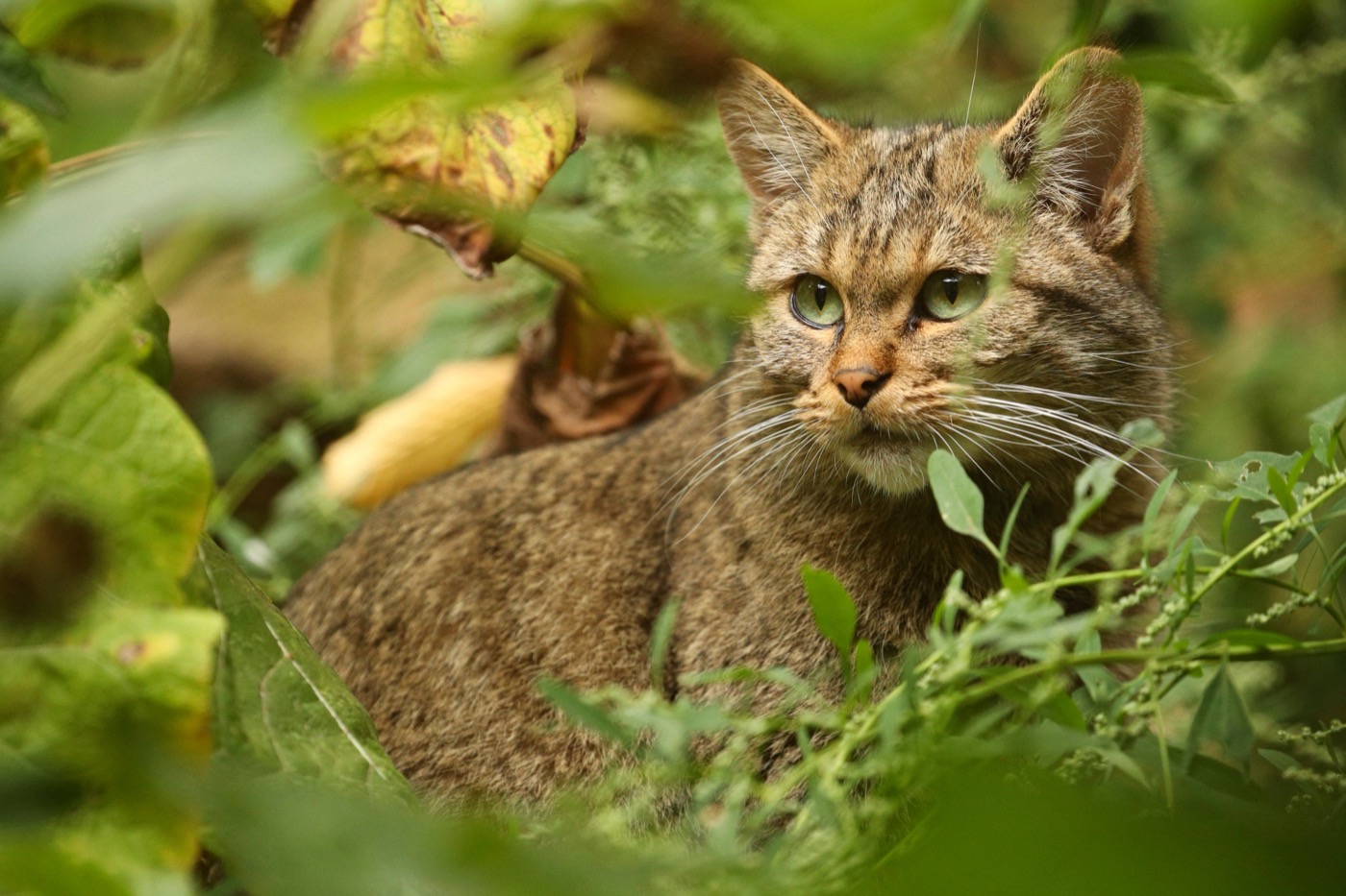
European wildcat
The wildcat needs old broadleaf forest with dead wood and cover, and that is exactly what grows here. It is shy and moves at dusk, so most guests meet one in a wildcat enclosure or follow its tracks on one of the trails.
 all year
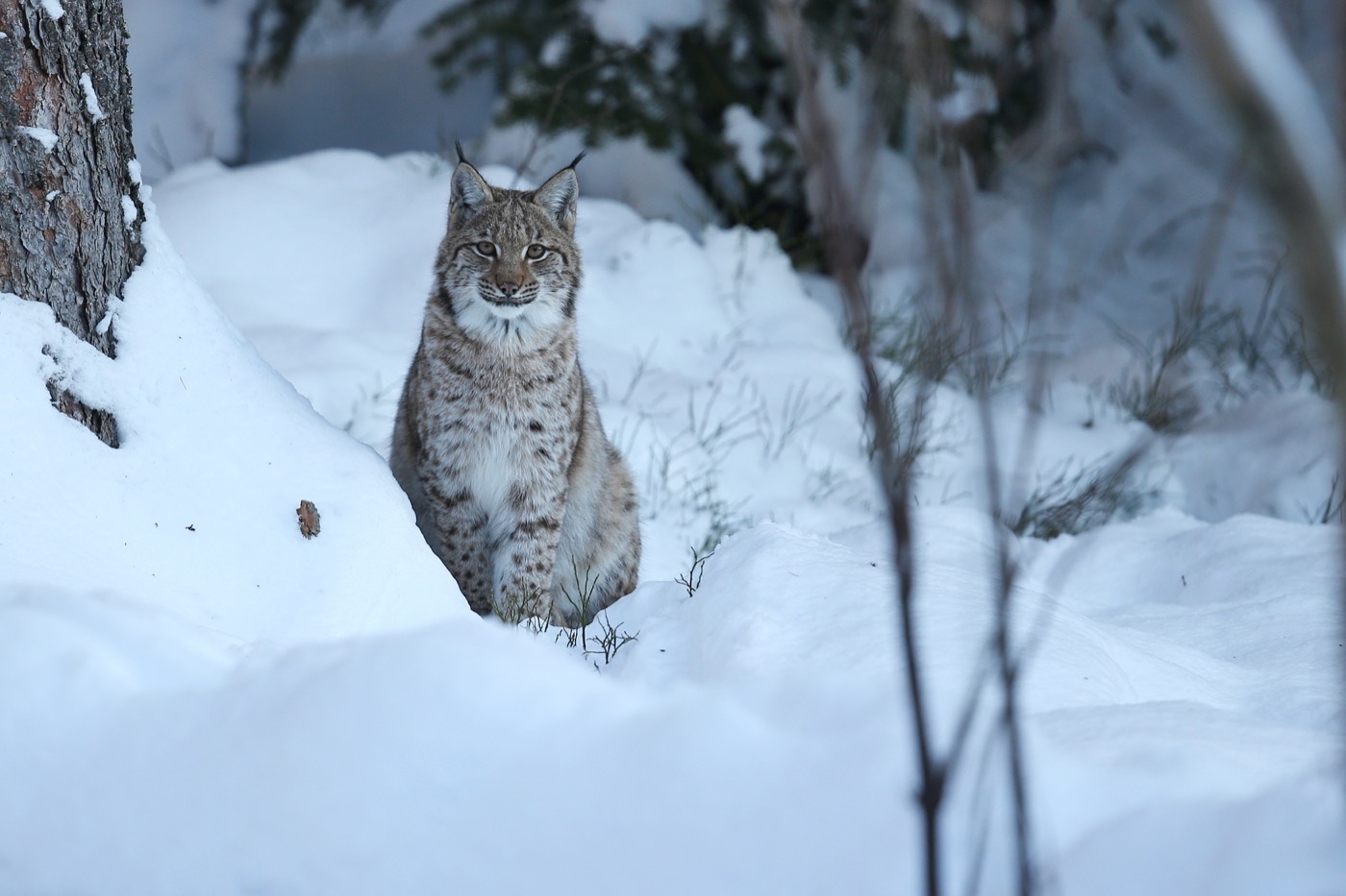
Eurasian lynx
The lynx had been wiped out in Germany and came back through releases, in the Harz, in the Bavarian Forest and since 2016 in the Palatinate Forest. Seeing one in the wild is luck; finding its tracks in snow is not unusual.
 March to June
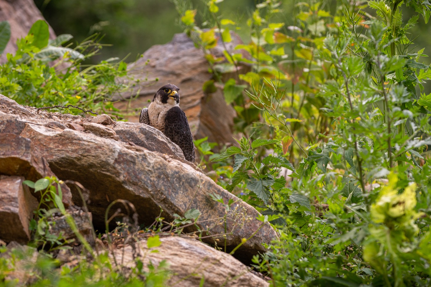
Peregrine falcon
The fastest animal on earth passes 300 kilometres an hour in a stoop. It nests on the cliffs above the rivers, and during the breeding season single climbing crags stay closed so it can raise its young in peace.
 May to August
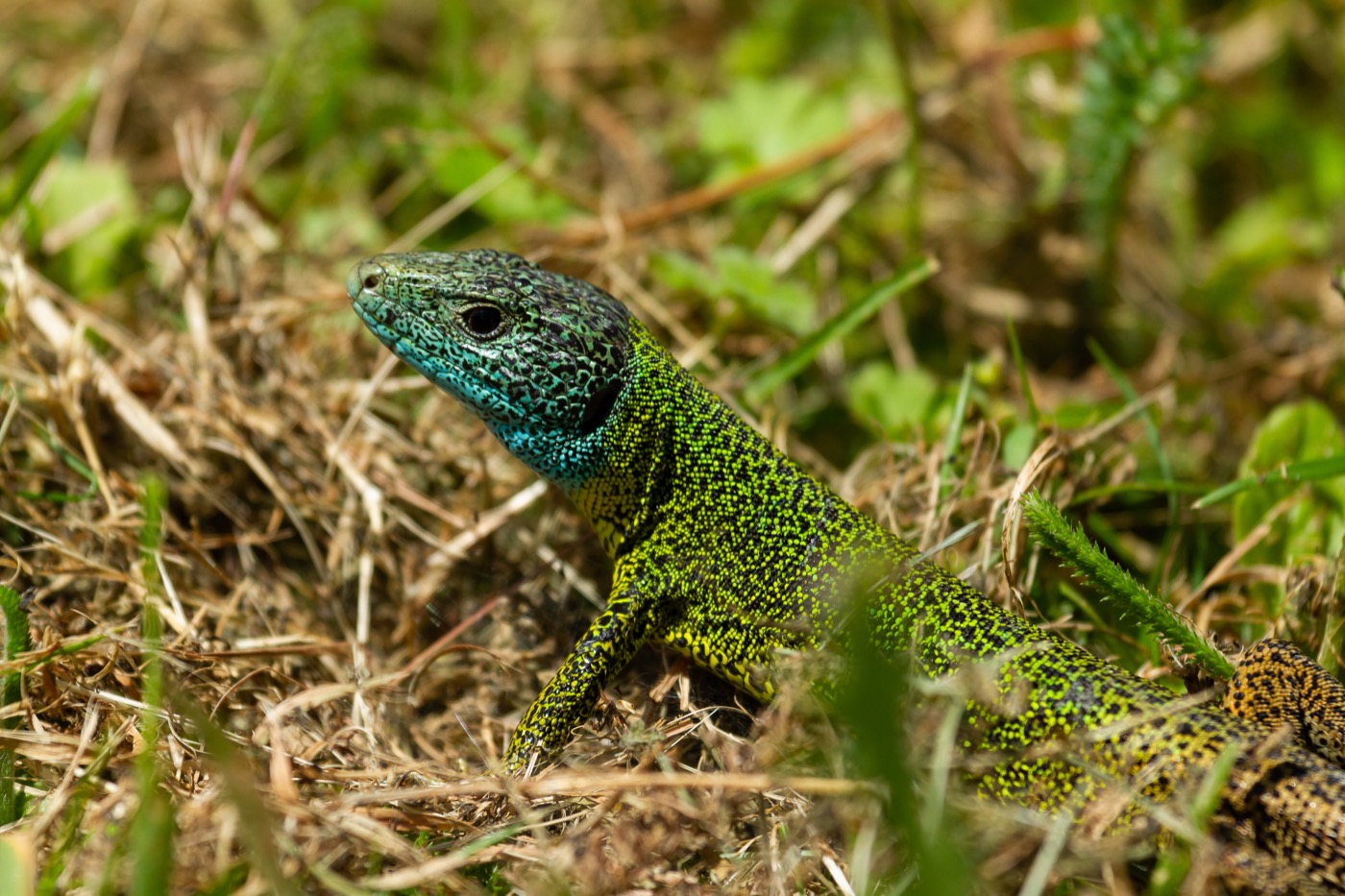
Green lizard
One of the few German populations lives on the hot dry slopes above the Middle Rhine. In spring the males are brilliant green with a blue throat, and they sun themselves on stone walls in the morning.
Pictures: Freepik
Getting there
- 1 h 00 minKoblenz
- 1 h 00 minTrier
- 2 h 00 minKöln
- 2 h 30 minFrankfurt am Main
- 3 h 50 minStuttgart
- 7 h 00 minHamburg
Good to know
Ferries cross the Middle Rhine
For some sixty kilometres between Koblenz and Bingen there is no bridge across the Rhine. To reach the other bank you take a ferry. The Loreley ferry between St. Goar and St. Goarshausen shuttles roughly every twenty minutes during the day.
High water on the Moselle and the Ahr
Sites right on the water close during floods, mostly between November and March. On the Ahr only part of the sites are back in service after the 2021 flood, more are being rebuilt. A phone call ahead saves the drive.
Steep slopes and narrow river roads
The roads along the Moselle are tight and winding, with narrow village crossings and, in places, low underpasses. The vineyard tracks themselves are built for tractors, not for motorhomes.
Fire in the Palatinate Forest
It is the largest continuous forest in Germany and correspondingly dry in summer. Open fire is banned all year, and at fire risk level four the municipalities close the barbecue huts as well.
Wildcats and walking trails
The European wildcat lives in the Eifel and the Hunsrück. Loose dogs are a danger to the kittens, so the state forestry and the national park ask you to keep dogs on a lead in the woods.
Eagle owls on the rock faces
Eagle owls nest on the sandstone crags of the Palatinate Forest and in the slate quarries. Between February and July single climbing routes are closed; the signs are at the foot of the route.
Protected landscapes
- National park
- Hunsrück-Hochwald
- Biosphere reserve
- Pfälzerwald-Vosges du Nord
- Nature park
- NassauNatur- und Geopark VulkaneifelHohes Venn-EifelRhein-WesterwaldSoonwald-NaheSüdeifelSaar-Hunsrück
Names and boundaries: © OpenStreetMap contributors.
About this region
Along the Moselle and the Ahr the road often runs right past the site, with the wineries in the same village. In the Palatinate Forest and the Hunsrück the sites are further apart, but the walking trail usually starts at the barrier.
The river valleys are warm and busy in summer, the Palatinate Forest stays cooler. Many sites sit right on the water, which has its advantages and one drawback.
